Ministry of Science & Technology
Union Minister Dr Jitendra Singh launches state-of-art latest National Survey Network; the nationwide "Continuously Operating Reference Stations" (CORS) Network will be operated by the Survey of India
“India now has a world class Precise Location based service, which is capable to provide centimetre level positioning services in realtime”: Dr Jitendra Singh
The Survey of India has set up more than 1,000 CORS stations across India
Impetus given to S&T and providing an enabling milieu for innovation are the hallmarks of the Government led by the visionary Prime Minister Shri Narendra Modi, says Dr Jitendra Singh
प्रविष्टि तिथि:
12 OCT 2023 4:56PM by PIB Delhi
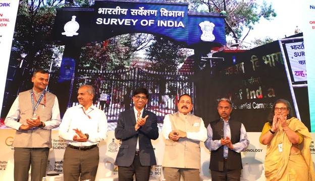
Union Minister of State (Independent Charge) Science & Technology, MoS PMO, Personnel, Public Grievances, Pensions, Atomic Energy and Space, Dr Jitendra Singh today launched state-of-art latest National Survey Network. The nationwide "Continuously Operating Reference Stations" (CORS) Network will be operated by the Survey of India.
“India now has a world class Precise Location based service, which are capable of providing centimetre level positioning services in realtime,” he said.
The Survey of India has set up more than 1,000 CORS stations across India.
Dr Jitendra Singh said we now have Indian data for Indian solutions.
“The Government has initiated several growth-oriented initiatives the SVAMITVA project for mapping of rural abadi areas, the PM-Gati Shakti National Master Plan for Multi-Modal Connectivity, Smart Cities & AMRUT Project for urban development, Bharatmala and Sagarmala Projects for improving the logistics sector, National Hydrology Project to harness water resources and multiple other infrastructural and developmental projects. The common thread among all these projects is the requirement of high-accuracy mapping and positioning data, the deregulation of Geospatial Sector and democratization of Geospatial data has resulted in ease of access to these datasets to various user groups,” he said.
In addition to the Geospatial sector, CORS based precision services will also boost auto navigation and machine control-based solution in Agriculture, Mining, Construction, Transport and Civil Aviation sector. This will open new domains of innovation and research and create a Geospatial based ecosystem in these sectors.
CORS data will also aid in various scientific studies like Upper Atmosphere and Space weather studies, Meteorology and weather forecast, Plate motion and Tectonic studies, Seismology and Hydrology etc. Nationwide CORS based services will be available to business and pubic, which will not only ensure coherence in geospatial data generated by different stake holders by providing them common reference, but will also increase their productivity.
Dr Jitendra Singh said an important hallmark of the Government led by the visionary Prime Minister Shri Narendra Modi is the impetus given to S&T and providing an enabling milieu for innovation.
“The Geospatial Guidelines of 2021 and National Geospatial Policy 2022 (NGP 2022) laid down a comprehensive plan for the transformation of the Geospatial sector in India. The sector is poised to play a strong role in helping the country realize the dream of making India a global economic powerhouse fueled by a large and young population, consistent economic reforms and a burgeoning technology sector. Two main goals of National Geospatial Policy were to develop a coherent national framework and to enable easy availability of valuable Geospatial data collected utilizing public funds, to businesses and the general public,” he said.
Dr Jitendra Singh said, in addition, the governance reforms initiated by PM Modi have ensured transparency, citizen centricity and zero tolerance for corruption. “Conscious effort has been made to use S&T to develop every sector, to provide every household the Ease of Living,” he said.
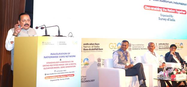
On the occasion, Dr Jitendra Singh inaugurated the stakeholder conference for Ortho rectified Image (ORI) and Digital Elevation Model (DEM). He also felicitated winners of Geospatial hackathon, conducted by Survey of India in partnership with IIIT Hyderabad and Microsoft Inc.
<><><><><>
SNC/PK
(रिलीज़ आईडी: 1967096)
आगंतुक पटल : 3765