Ministry of Science & Technology
Stakeholders discuss the implications & implementation of the Guidelines for acquiring & producing Geo-Spatial Data and Geo-Spatial Data Services including Maps
This is an opportunity for Indian industries to set up mapping and a transformative one for both industry and science:Professor K VijayRaghavan, Principal Scientific Adviser to the Government of India
The guidelines will stimulate and empower Indian industry and surveying agencies without diluting security concerns: Prof Ashutosh Sharma, Secretary, DST
Geospatial policy is going to do wonders for the country bringing new avenues:Dr.K.Sivan, Secretary, Department of Space
प्रविष्टि तिथि:
19 FEB 2021 6:12PM by PIB Delhi
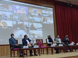
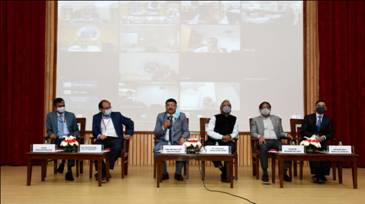
Dignitaries from a range of domains discussed the implications and the road to implementation of the recently released Guidelines for acquiring and producing Geo-Spatial Data and Geo-Spatial Data Services including Maps at stakeholders meet on the issue.
“As the next generation of mapping technologies develop, these guidelines will enable Indian innovators to make advanced maps at the highest resolution, empower small businesses, and make our lives easier,” said Principal Scientific Adviser to the Government of India Professor K VijayRaghavan at the stakeholder’s meet organized on February 19, 2021.
“The new geospatial guidelines have liberated this sector and have implications in several areas, whether it is mapping our biodiversity, our rivers, and mountains, or using such data for health-care delivery, agriculture, or urban planning. This is an opportunity for Indian industries to set up mapping and a transformative one for both industry and science,” he added.
Secretary Department of Science and Technology (DST), Prof Ashutosh Sharma, said that the guidelines will stimulate and empower Indian industry and surveying agencies without diluting security concerns. Atmanirbharta in Geospatial products and solutions can bring around one lakh crore business by 2030 and will also have economic impact through development.
“Surveying and mapping is very critical to planning and execution, and the guidelines will lead to liberalization of the process of approval, democratization of geospatial data, and Atmanirbharata in the sector. Our corporations and innovators will not require prior approvals before they collect, generate, prepare, disseminate, store, publish, update digital geospatial data and maps within the territory of India and it will also lead to fair and transparent pricing of related products,” he pointed out.
Secretary, Department of Space Dr.K.Sivan pledged support for implementation of the geospatial guidelines. He said that the space-based remote sensing policy that ISRO has now put in the public domain and the geospatial policy is going to do wonders for the country bringing new avenues.
He added that ISRO is committed to seeing all Indians benefit from the good work that has been done at MapmyIndia over the last 25 years and helping accelerate India’s rise as the most advanced country in the world through the full power of our maps and geospatial technologies, all developed indigenously in India, for India, and in future, for the world.
Principal Economic Adviser Shree SanjeevSanyal elaborated on the history of cartography and the relevance of the guidelines in that context. He said that the guidelines are historic at multilevel, and the Indian companies can now use it for the development of society and the country. The announcement will lead to full liberalization of the cartography and geo-spatial mapping sector, for the first time, this sector is open to private innovation.
The meet was attended by representatives from several stakeholders like industry, startups, academia, surveying agencies, and government ministries and departments who participated in a panel discussion organized on the occasion.
The Government has recently announced liberalised guidelines for geo-spatial data. The guidelines drafted by the Department of Science and Technology bring sweeping changes to India’s mapping policy, specifically for Indian companies.
With the advent of publicly available geospatial services, a lot of Geospatial Data that used to be in restricted zone would be freely and commonly available now, and some of the policies/guidelines that used to regulate such information have been rendered obsolete and redundant. The guidelines would ensure what is readily available globally does not need to be regulated. For Indian entities, it would mean complete deregulation with no prior approvals, security clearances, licenses, etc. for acquisition and production of geospatial data and geospatial data services, including maps
High spatial accuracy geospatial data finer than 1m horizontally and 3m vertically can now be acquired and owned only by Indian entities and stored in servers physically located in India Government agencies, and others will collaborate and work towards open-linked geospatial data.
The stakeholders benefitted will include practically every segment of society, from industry to academia to government departments. No security clearances are required for acquisition of Geospatial data for SWAMITVA Project launched by Hon’ble PM to provide ownership titles to villagers for abadi areas, National Hydrology Project, preparation of High-Resolution National Topographic Data Base, Geoid model, etc. by Survey of India, Industry, academia, for researchetc. It would also ensure ease of doing business, promoting innovation and unlocking of potential in the Geospatial sector.
*****
NB/KGS/(DST Media Cell)
(रिलीज़ आईडी: 1699444)
आगंतुक पटल : 890