Ministry of Science & Technology
Experts discuss ways to transform India through Geospatial knowledge & infrastructure
प्रविष्टि तिथि:
03 MAR 2022 3:40PM by PIB Delhi
Experts discussed ways for transforming India through geospatial knowledge and infrastructure with the help of national geospatial policy that can facilitate the accessibility of data, create effective human resources, encourage collaboration between government, industry, and academia as knowledge partners and increase the usability of the data, at a breakaway session of the post-budget webinar on Technology-Enabled Development inaugurated by the Prime Minister.
“Data generation and data governance are crucial components of geospatial technologies, and effective collaboration between government, academia, and industry is needed for them. The government is removing all restrictions to resolve the issues for better outreach of the data. Once the data is made accessible, its potential is immense to provide solutions in numerous sectors. In order to effectively implement all these, trained man power is necessary at all levels,” said Dr. Kiran Kumar, former Secretary, Department of Space and former Chairman, ISRO, at the breakaway session titled ‘Transforming India through geospatial knowledge and infrastructure: the need for national geospatial policy’, led by the Department of Science and Technology (DST).
“We need to have mechanisms in which the government and industry can work as partners; validations can be given to the solutions provided by the industry, and we need the right people with the right skills who can take these initiatives forward. The Budget 2022 discussed the data collection and its accessibility, and this needs to be leveraged,” Dr. Kumar added at the webinar on 2nd March 2022. The webinar titled “Technology-enabled development” was organized by Office of the Principal Scientific Adviser (PSA) along with several scientific ministries and departments of the Government of India.
Dr. Shanthanu Bhatawdekar, Director, EOA & DMS Program Office, ISRO, highlighted that the government should share domain expertise in this area with the private for deeper penetration of the technologies. A federated ecosystem should be built for government and non-government entities to minimize redundancy and make data easily accessible. He also underlined the need for ministries, line departments, and the geospatial industry to work in unison.
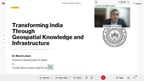
“We need a roadmap for geospatial R&D system, technology generation, education, data sharing, encouraging academic startups, and we need to leapfrog to meet the global benchmark, said Dr. Bharat Lohani, Professor, IIT Kanpur. He also emphasized on the need for standaisation of data and its unification on the basis of the quality of data.
Dr. Prakash Chauhan, Director, Indian Institute of Remote Sensing (IIRS), Dehradun stressed on enhancing the reach of geo-spatial data in terms of user specifications to be used in different sectors. “In India, there exist different mechanisms for the generation of data and their availability. A proper channel of updating those data and collating the data is necessary. Besides, we need to create a localized ecosystem to harness the IT capabilities of the country and localized data for creating a foundation for development of Geospatial Technologies. ISRO has created a dataset, and it needs to be disseminated through cloud-based services,” he added.
Drawing on current geopolitical scenarios, Mr. Rakesh Verma, Chairman, MapMyIndia, underlined the increasing necessity to develop indigenous technologies and disseminate them to the users to minimize the dependency on foreign entities. He said that there is no dearth of talent in India, and hence the Geospatial industry could be Atmanirbhar with such resources. He highlighted examples of mobile mapping developed in India, which can be extended to the entire country.
“We need to develop indigenous software and hardware by supporting indigenous companies, and this would require creating industrial capacity, incubators, mobilizing capital, some of which may be in the form of geospatial industrial development fund, public-private partnerships, international competitiveness, local manufacturing, and finally a sound industrial strategy for manifold growth,” Mr. Sanjay Kumar CEO, Geospatial World, pointed out.
Ms. Abhilasha Purwar, Founder & CEO, Blue Sky Analytics, highlighted ways in which the geospatial data can make India a leader in climate action and discussions by incorporating satellite intelligence and data into the climate discussions.
Joint Secretary, Department of Science and Technology (DST), Shri Sunil Kumar, highlighted the government reforms in geospatial technology and drone technology and also discussed about SWAMITVA Project to provide ownership titles to villagers.
The final recommendations included leveraging human capital that the country already has to develop products and solutions using geospatial data, introduction of new courses at UG and PG level in Geo-informatics, standardization of professional services provided by surveyors and GIS professionals through industry-led certification and research emphasis in areas like high-resolution Geospatial datasets. The recommendations also involved encouraging local cloud services, improvement of public procurement by way of quality RFP documents, developing expertise in evaluating and certifying tender works as per laid out specification, moving beyond tenders to collaborate with industry, leveraging government data and technology of the industry to build revenue models, improvement in capital availability to start ups and other businesses, geospatial investment fund, geospatial industry development strategy as well as sectoral development plans.


*****
SNC / RR
(रिलीज़ आईडी: 1802647)
आगंतुक पटल : 1720