Ministry of Road Transport & Highways
CORS-Based Precision Positioning Set to Transform Highway Construction with Centimetre Accuracy
Posted On:
30 APR 2026 5:42PM by PIB Raipur
National Highways Authority of India (National Highways Authority of India–NHAI), in collaboration with the Survey of India, organised a one-day workshop on “Precision Positioning Services through Continuously Operating Reference Stations (Continuously Operating Reference Stations–CORS) Network,” aimed at enhancing the planning, surveying and execution of national highway projects through advanced geospatial technologies.
7OG2.jpeg)
The workshop focused on overcoming the limitations of the conventional Global Positioning System (Global Positioning System–GPS) by promoting the adoption of CORS-based positioning, which enables high-precision, real-time data access for infrastructure development. The initiative is expected to significantly improve the accuracy, efficiency and transparency of highway construction processes.
1CCD.jpeg)
Addressing the participants, Regional Officer of the National Highways Authority of India (National Highways Authority of India–NHAI), Shri Pradeep Kumar Lal, highlighted that the adoption of CORS technology would usher in a new era of smart and modern highway construction. He stated that real-time, high-accuracy data would empower engineers and contractors to execute projects with greater precision, ensuring adherence to global standards while improving operational efficiency and transparency.
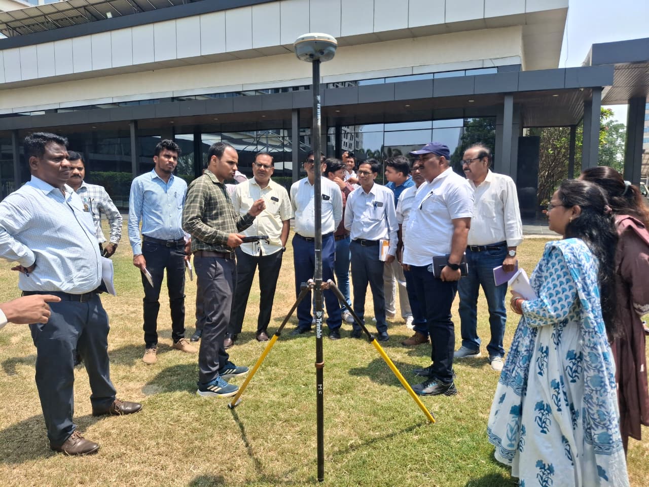
In the technical session, Superintendent Surveyor (In-charge, Chhattisgarh) of the Survey of India, Shri Rajesh Ranjan, explained that the CORS network represents a robust and modern geospatial infrastructure capable of delivering highly accurate positioning services across the country. He noted that its application in the highway sector would facilitate error-free digital mapping and reliable data collection, even in complex terrains.
EZKS.jpeg)
Official Surveyor Shri Prabhat Kumar Pradhan further elaborated that CORS technology enables centimetre-level accuracy in survey and construction activities. He underlined that the system supports real-time monitoring, enhances construction quality and contributes to substantial savings in both time and project costs.
The workshop was attended by Project Director Shri D.D. Parlawar, Shri Digvijay Singh, Shri Mukesh Kumar, and Executive Engineer Shri Ramveer Yadav from the Ministry of Road Transport and Highways, along with other officials and staff members.
********
RJD / BT
(Release ID: 2257006)
Visitor Counter : 91